|
|
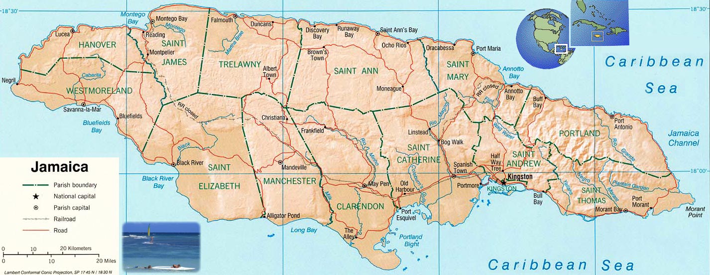
St. Elizabeth, Jamaica's second-largest parish, is located in the southwest of the island, in the county of Cornwall. Its capital, Black River, is located at the mouth of the eponymous stream, the longest on the island.
Brief history
Saint Elizabeth originally included most of the south-west part of the island, but in 1703 Westmoreland was taken from it and in 1814 a part of Manchester. The resulting areas were named after the wife of Sir Thomas Modyford, the first English Governor of Jamaica.
There are also traces of Taínos/Arawaks existence in the parish, as well as Spanish settlements. After 1655, when the English settled on the island, they concentrated on planting sugar cane. Today, buildings with 'Spanish wall' (masonry of limestone sand and stone between wooden frames) can still be seen in some areas.
St Elizabeth became a prosperous parish and Black River an important seaport. In addition to shipping sugar and molasses, Black River became the centre of the logging trade. Large quantities of logwood were exported to Europe to make a Prussian-blue dye which was very popular in the 18th and 19th centuries.
Electric power was first introduced in Jamaica in a house called Waterloo in Black River in 1893.
Geography
The parish is located latitude 18°15'N, and longitude 77°56'W; to the west of Manchester, the east of Westmoreland, and to the south of St. James and Trelawny. It covers an area of 1212.4 sq km, making it Jamaica's second largest parish, behind Saint Ann's 1212.6 sq km.
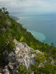
The northern and northeastern parts of the parish are mountainous. There are three mountain ranges —the Nassau Mountains to the north-east, the Lacovia Mountains to the west of the Nassau Mountains, and the Santa Cruz Mountains which, running south, divide the wide plain to end in a precipitous drop of 1600 feet at Lovers' Leap. The central and southern sections form an extensive plain divided by the Santa Cruz Mountains. A large part of the lowlands is covered by morass, but it still provides grazing land for horses and mules.
The main river in the parish is Black River, and measuring 53.4 kilometres (33 miles), it is the longest river in Jamaica. It is navigable for about 40 kilometres (25 miles), and is supported by many tributaries including Y.S., Broad, Grass and Horse Savannah. The river has its source in the mountains of Manchester where it rises and flows west as the border between Manchester and Trelawny then goes underground. It reappears briefly in several surrounding towns, but reemerges near Balaclava and tumbles down gorges to the plain known as the Savannah, through the Great Morass and to the sea at Black River, the capital of the parish.
There are many limestone formations in the parish, resulting in the formation of 44 caves. These include Mexico, the longest in the island; Yardley Chase Caves near the foot of Lovers' Leap; Wallingford Caves near Balaclava, famous for the fossil remains of large extinct rodents; and Peru Cave near Goshen which has stalactites and stalagmites. Mineral deposits include bauxite, antimony, white limestone, clay, peat and silica sand which is used to manufacture glass.